- Home
- Bushwalking
12 Top Central Coast Walks You Must Do

The Central Coast is fortunate to have many stunning walks that are suitable for the whole family. To make things easier for you, I have listed our 12 favourite walks. Each and every one is fabulous.
The kids and we never get tired of these walks because each offers its unique adventure.
We have sorted the list from shortest to longest, so you can choose the one that best suits your preferences.
Walks |
Distance |
|
1. |
200 m one-way | |
|
2. |
500 m return | |
|
3. |
1.5 km return | |
|
4. |
1.8 km return | |
|
5. |
4.6 km return | |
|
6. |
4.7 km loop | |
|
7. |
6 km return | |
|
8. |
6 km return | |
|
9. |
7.5 km loop | |
|
10. |
7.7 km loop | |
|
11. |
8 km one-way | |
|
12. |
10 km one-way |
1. Terrigal Boardwalk

Want to enjoy a relaxing stroll while marvelling at stunning ocean views?
The 200m boardwalk connects Terrigal Haven to the lively town of Terrigal. It's undoubtedly one of the prettiest spots on the Central Coast.
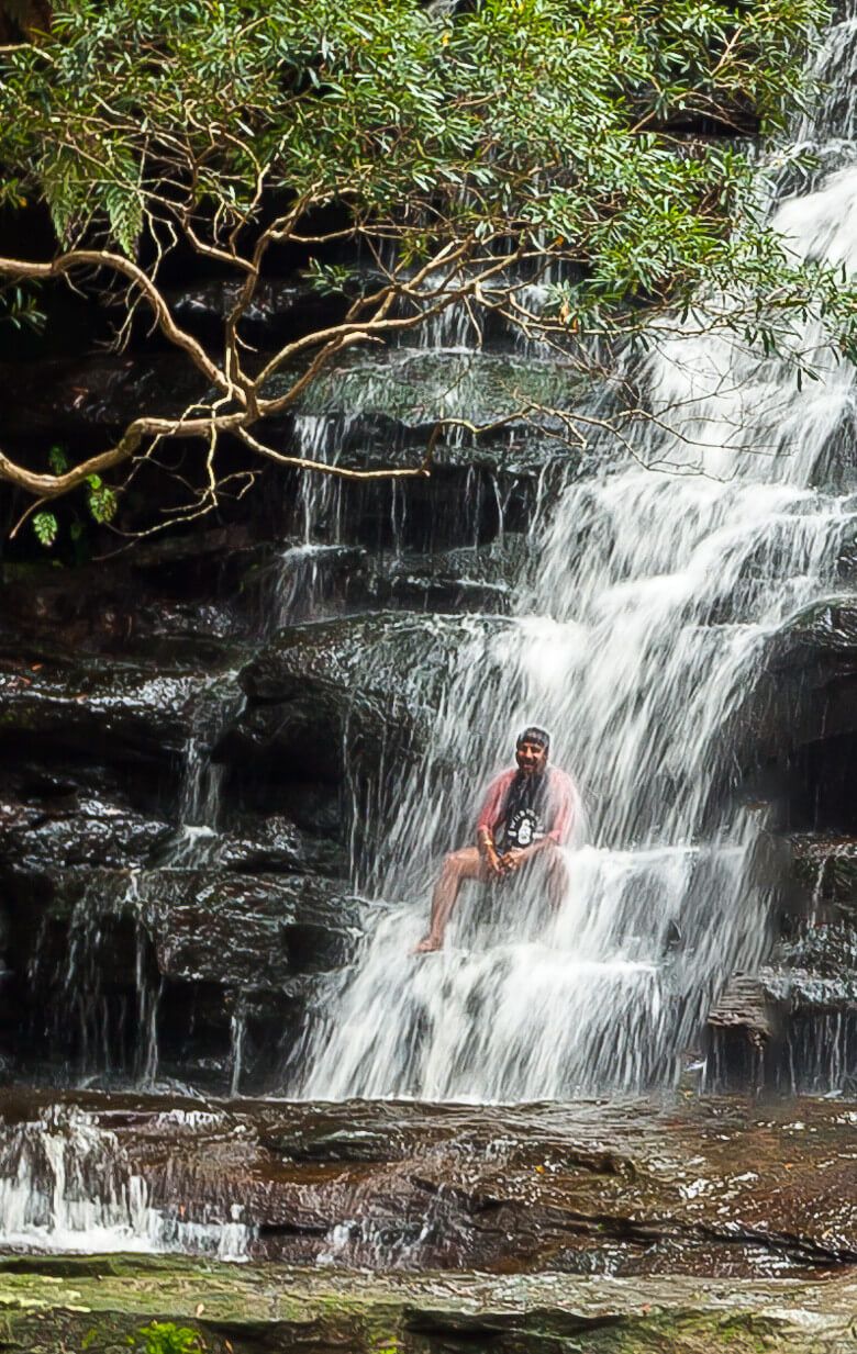
2. Somersby Falls Walking Track

Somersby Falls are the most popular waterfalls on the Central Coast.
It's a perfect walk to do in summer because the dense rainforest keeps you cool.
Located in Somersby.
3. Little Beach Trail

Enjoy a relaxing stroll with friends and family through a beautiful remnant rainforest.
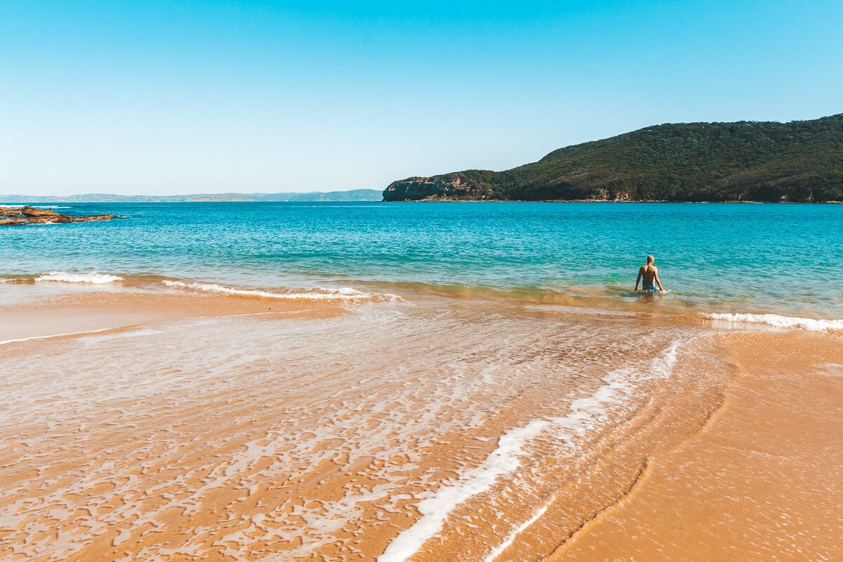
This easy bush walk leads to Little Beach, a secluded cove in Bouddi National Park.
4. Maitland Bay Track

The Maitland Bay track in Bouddi National Park is a short but steep bushwalk. It winds down to the secluded Maitland Bay beach through gullies and lush vegetation.
5. Kariong Brook Falls Walk

Kariong Brook Falls is a lovely waterfall in Brisbane Water National Park.
Surrounded by rock ledges and lush vegetation, it feels like a sanctuary. The beautiful swimming hole at the bottom of the fall makes it even more inviting.
6. Piles Creek Loop

Piles Creek loop is an enchanting bushwalk in Brisbane Water National Park.
Hike underneath sandstone caves, over an old suspension bridge and past waterfalls. And if you go in spring, past tons of pretty wildflowers.
7. Pearl Beach to Patonga Walk

If you can only experience one hike, this one should be at the top of your list.
The Pearl Beach to Patonga walk is a top contender for one of the most scenic Central Coast bushwalks.
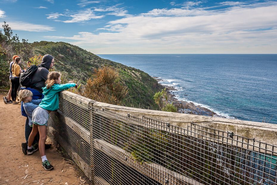
8. The Coast Walking Track

Following the coastline between Bateau Bay and Forresters Beach, The Coast walking track offers stunning ocean views.
The walk is in Wyrrabalong National Park and is easily accessible to most holidaymakers.
9. Coast to Lake Walk

The Coast to Lake walk is terrific particularly if you don't like hills.
The walk is varied – perfect for those wanting to enjoy cafes, scenic coastal views and swimmable beaches.
Located in The Entrance area.
10. Mount Wondebyne Loop
Distance: 7.7 km loop
Duration: 2 hrs 15 min
Difficulty: Easy except for the climb to the mount's summit
The Mount Wondabyne Loop takes you on a relaxing journey deep into the bush.
The highlight of the walk is the stunning 360-degree views from the summit of Mount Wondebyne in Brisbane Water National Park.
11. Bouddi Coastal Walk

The Bouddi Coastal Walk is the most popular hike on the Central Coast.
Following the coastline between Killcare and Macmasters Beach, the hike offers spectacular ocean views all the way and passes stunning beaches.
12. The 5 Lands Walk

The 5 Lands Walk is a magnificent 10-kilometre hike that traverses five beaches.
This organised event happens on the Saturday closest to the winter solstice. You're sure to spot migrating whales.
The walk begins at Macmasters Beach and ends at Terrigal.
Want to Find Out more Bushwalks? Then Check Out These Other Great Ones...
- Bouddi National Park walks
- Brisbane Water National Park walks
- Ku-ring-gai Chase National Park walks
- Wyrrabalong National Park walks
You May Also Like
27 Best Central Coast Attractions with Hidden Gems
A local's guide to the best Central Coast attractions and activities
Somersby Falls - iCentralCoast
Somersby Falls is one of the most popular attractions on the Central Coast NSW. Find out here what to expect during your visit.
Wyrrabalong National Park Walking Tracks - iCentralCoast
Local's guide to walking in Wyrrabalong National Park. The Coast walking track is a favourite.
* As an Amazon Associate, I earn from qualifying purchases.
* Amazon and the Amazon logo are trademarks of Amazon.com, Inc. or its affiliates.
Copyright © 2016-2025, iCentralCoast | All rights reserved. | Privacy Policy & Disclaimer
Site by The Phoenix Digital