- Home
- Brisbane Water National Park
- Piles Creek Loop
Piles Creek Loop - Complete Guide

Piles Creek loop is one of the Central Coast most riveting walks.
Located in Brisbane Water National Park, the track contains pretty wildflowers, sandstone caves, an old suspension bridge, and small waterfalls.
The walk attracts locals and visitors who want to experience
a challenging but enchanting hike, often combined with their visit to the nearby
Australian Reptile Park or Somersby Falls.
Piles Creek loop is one of my favourite hikes!
This guide will show you the highlights of the walk and tell you how to get there.
This post contains affiliate links. For more information, please read my disclosure.
Contents:
PILES CREEK LOOP:
Distance: 4.7 km
Time: 3.5 hours
Difficulty: Grade 5
Visitor Information
Piles Creek loop starts at Girrakool Picnic Area in Brisbane Water National Park. Check Girrakool Picnic Area on Google Maps.
From the Pacific Motorway, exit Central Coast Highway towards Gosford, take the first left onto Wisemans Ferry Road, take the first left onto Old Pacific Highway and take the first left onto Quarry Road.
Drive through the tunnel to the end of the road, at Girrakool Picnic Area.
There’s a large carpark – parking costs $8 for the day.
The carpark opens daily from 7 am to 8 pm during daylight savings and 7 am to 6 pm the rest of the year.
Girrakool Picnic Area
Girrakool Picnic Area contains barbecues, picnic tables and toilets – a great spot for a picnic after your walk.
There’s plenty of space for kids to run around, and you may even spot a wallaby.

Dogs are not allowed here because it’s in a national park.
Two trails start from Girrakool Picnic Area: the Piles Creek loop and the Girrakool loop track.
Girrakool loop track is shorter and easier than the Piles Creek loop, but not as nice because of the noisy motorway. But the Girrakool loop track is popular with families with preschool children.
The Great North Walk can also be accessed from Girrakool Picnic Area.
Map of Piles Creek Loop
There’s a large map located at the picnic area indicating the location of the walks:

Highlights of Piles Creek Loop
The trails at Girrakool were built to allow people to access and appreciate the beautiful flora, waterfalls, and magnificent surroundings.
The area was used in the past by Aboriginal people. There are plenty of engravings on sandstone outcrops.
The track follows the left side of Piles Creek through dry eucalypt forest and takes you down the gorge through rainforest gullies. Then it takes you across the old suspension bridge, where you can hear the soothing sound of the running creek.
Finally, back up toward Girrakool Picnic Area along the right side of the stream.
If you go in spring, you’ll see tons of gorgeous wildflowers along the track. You’ll feel like you’re in a fairy garden.

The only thing I dislike about this walk is the constant humming of the motorway, but the noise fades as you approach the bottom of the gorge.
Piles Creek loop contains steep parts, but I’ve seen kids from about seven years old hike it.
First Half: From Girrakool Picnic Area to the Suspension Bridge
From Girrakool Picnic Area, follow the sign on the right side of the toilet block.
The path leads to an intersection that indicates Broula lookout track.
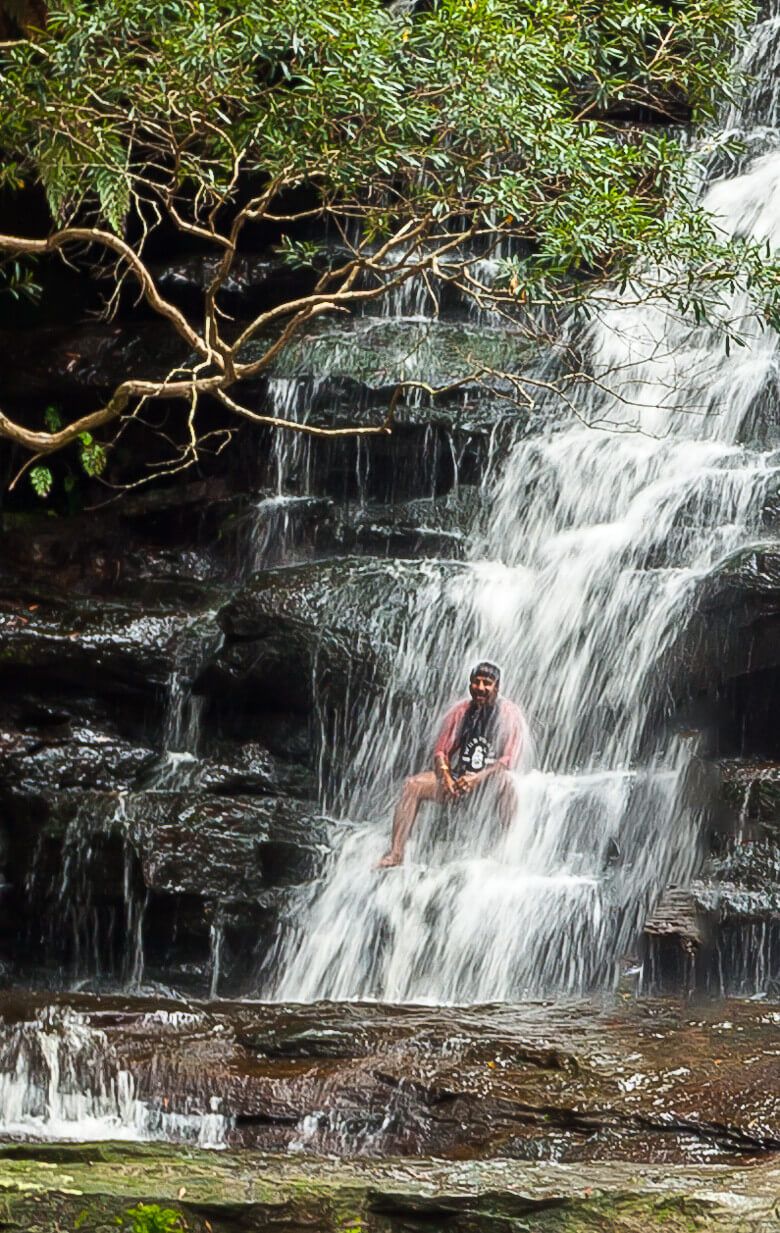
The lookout provides a filtered view of Piles Creek waterfall.
Retrace your step and continue walking to Illoura Lookout, which is at the Piles Creek loop and Girrakool loop track intersection.
Illoura Lookout provides a view of the junction of Piles and Leask Creeks.
Veer left then go down the stairs.
At the bottom, step on the concrete pillars to cross the creek and continue along the winding track to a lookout that offers extensive views over the steep valley.

Then continue winding along the wildflower scattered path and underneath sandstone caves.
You’ll come across the junction of the Great North Walk, which leads to Patonga or Somersby, before making your way to the suspension bridge at the bottom of the gorge where you’ll cross Piles Creek.
Second Half: From the Suspension Bridge to Girrakool Picnic Area
Follow the track on the other side of the bridge, which will soon start reascending the valley. The path winds over stone and concrete stairways and wooden bridges.

The tree canopies and rock overhangs cool you down, which
facilitates the ascend.
Then you’ll reach Bundilla lookout before arriving at the intersection of Girrakool loop track and Piles Creek loop.
You can then walk a bit further along the Girrakool loop track or head straight to the carpark.
For more information: NSW National Parks and Wildlife Service
Other Walks in Brisbane Water National Park
Brisbane Water National Park contains plenty of other great hikes worth doing. Check out:
You May Also Like
Somersby Falls - iCentralCoast
Somersby Falls is one of the most popular attractions on the Central Coast NSW. Find out here what to expect during your visit.
Wyrrabalong National Park Walking Tracks - iCentralCoast
Local's guide to walking in Wyrrabalong National Park. The Coast walking track is a favourite.
Bouddi Coastal Walk: A Complete Guide - iCentralCoast
Bouddi Coastal Walk has been nominated as “one of the 18 best day walks in Australia”. No wonder… the coastal views are scenic.
* As an Amazon Associate, I earn from qualifying purchases.
* Amazon and the Amazon logo are trademarks of Amazon.com, Inc. or its affiliates.
Copyright © 2016-2025, iCentralCoast | All rights reserved. | Privacy Policy & Disclaimer
Site by The Phoenix Digital